After crossing Puerto de los Hidalgos, Alonso de Hojeda’s expedition descended south into the great valley of the modern Dominican Republic that Columbus would name La Vega Real (the Royal Plain). Journeying for two weeks, the men forded the Yaque River (which retains its Taíno name today), continued southward to ascend into the rocky, mountainous region that the Taínos called the “Cibao,” traded peacefully for gold (mostly jewelry) with local Taíno chieftains, and returned to Isabela on January 21, 1494 (528 years ago).
When recounting his travels, Marco Polo had referred to modern Japan as “Cipangu,” and at this time, Columbus clung to the belief that the Taínos’ “Cibao” was none other than Marco Polo’s “Cipangu”—and that “Española” was an island close offshore Cathay.
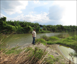
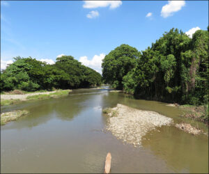
On my trip to the Dominican Republic in 2019, I attempted a speculative reimagination of the approximate route of Hojeda’s march, based on imprecise primary sources and historians’ conflicting analyses, as well as largely constrained by traveling on modern back roads open to the public. As depicted in Columbus and Caonabó, my speculation is that Hojeda forded the Yaque somewhere between two of its tributaries, the Mao and the Amina (which also retain their Taíno names today), and then traced the Amina (which supplied drinking water) to ascend into the Cibao.
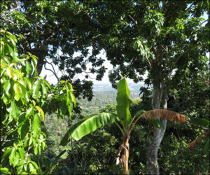
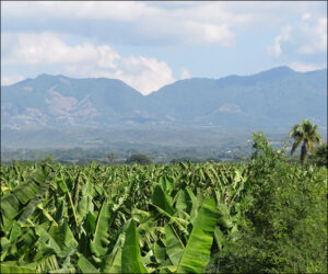
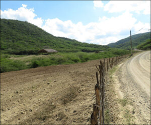
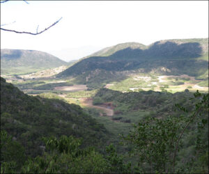
The following photos show: a view from Puerto de los Hidalgos south through forest down toward the Vega Real; a view from the Yaque on the Vega Real back north toward the location of Puerto de los Hidalgos; the Yaque between its junctures with the Amina and Mao (with Frank Coste, the Dominican archaeologist responsible for overseeing the Vega Vieja archaeological park); the Amina on the Vega Real before ascending in the Cibao’s foothills; commencement of ascent into the Cibao’s foothills; and farther ascent.
Columbus largely would replicate the journey in March 1494, prelude to marching farther into the Cibao to establish his first inland fort.
