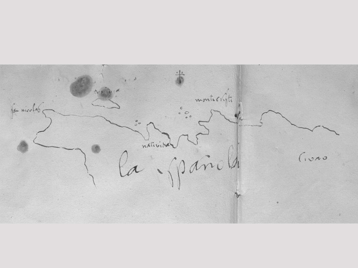
I suspect Columbus drew his famous sketch of Española’s northwestern coast on or about January 11, 1493, when the Niña would have progressed to the point where the map’s coastline ends in the east. The original sketch has been in the collection of the Duques de Alba.

